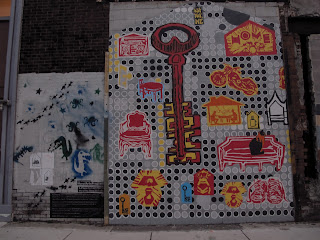
My final project consisted of adding a digital interface to my analog street art project. Part 1 of my analog project consists of a series of photographs taken around the Lancaster area that depict the little things (that I at least found enjoyable) that I feel most people walk by every day without noticing. Most of these little things consist of natural elements creeping in through the cracks in the infrastructure of Lancaster. I took these photographs (from the Invisible City project), laminated them, sliced puncture holes through them, and hung them with red yarn on a poster board fence frame on the corner of 36th and Lancaster. I felt that this was interactive and allowed people to pick up the photographs physically, turn them over in their hands, and pick up others. I also wrote "This is Lancaster" on the back of the photographs to show people that these photographs of beautiful things are actually in the Lancaster area, which is not terribly well known for having beautiful things at all. It was also a tribute to a friend of mine who, upon looking at these photos, exclaimed, "This is Lancaster?!" Yes indeed. And so, as an affirmation to anyone who looks upon them, this is, in fact, Lancaster.
My part 2 for the photo project was, again, analog. I plotted out on a map where the physical locations of the photographs were in Lancaster, took a black sharpie, and wrote physical directions to each location on the back of each corresponding laminated photograph so that people may find the actual locations and see what I saw. I find that a big part of the disparity between photographs and viewer is that people often have trouble imagining that these photographed places really exist in real time, and further have even more trouble imagining what the photographer must have seen to warrant taking a photo. I want to take people to these places to show them that they do in fact exist and that there may be a large difference in perspective of environment between a foreigner with a camera and an everyday resident. I realized in the middle of my endeavor to transcribe all these locations that some of the directions were wrong. I gave directions using blocks (i.e., travel 3 blocks north, turn right, head east for a block and a half, etc.), not realizing that I determined the blocks by street number instead of actual physical block. Because the streets are numbered (i.e., 35th, 36th, 37th, etc.) I used those to determine blocks, but realized halfway through that there are streets in between the numbered ones which people will count as blocks, and so 3 blocks west doesn't get me to 39th, but actually gets me to 38th or so because of the streets in between. I corrected my mistake but the incorrect directions are still on many of the photos, unfortunately.
My 3rd and final installation is a digital map of my photo locations on UMapper. I made a virtual map of all my photo locations and, with little markers, posted descriptions of what I saw when I was at these locations and took these photos. I also made a little path to take people around to each photo location which links them all together. Even if people don't want to take a photo tour, this is still a lovely walk to take just for fun. In order to make my project applicable and accessible to the general public (at least, the general public with smartphones) I generated QR codes, printed them, and cut them out to place them around on each photo and at each location I photographed. I wanted to put photographs in the places I marked off on the map but, for some reason (even though I fixed the photographs to be the correct accepted file type) they are not uploading. Even my computer science friends are stumped by this, so I know it's not just me being stupid and forgetting something. Alas. I shall post the photos here I suppose, of both my photography in this art installation and of the installation itself. The installation, although put up about a month ago, is still largely intact, which is surprising but hey, I'm happy about it.
Here's a link to UMapper, in case you missed my earlier post and want to visit my collection map:
CLICK ON ME!
And check these bad boyz out: this is the actual selected photography from my Invisible City project that I picked to illustrate the character of the neighborhood. If you've seen the Invisible City post, you might find this to be familiar. If not, CHECK IT OUT HERE! There are a lot more pictures to see there anyway.
*ALSO* These photographs are in chronological order for the UMapper walk, so keep these in mind if you visit the map site and want to know what the photographs actually looked like (since the site is still being DUMB and not letting me upload photos...)
Enjoy :)


No comments:
Post a Comment